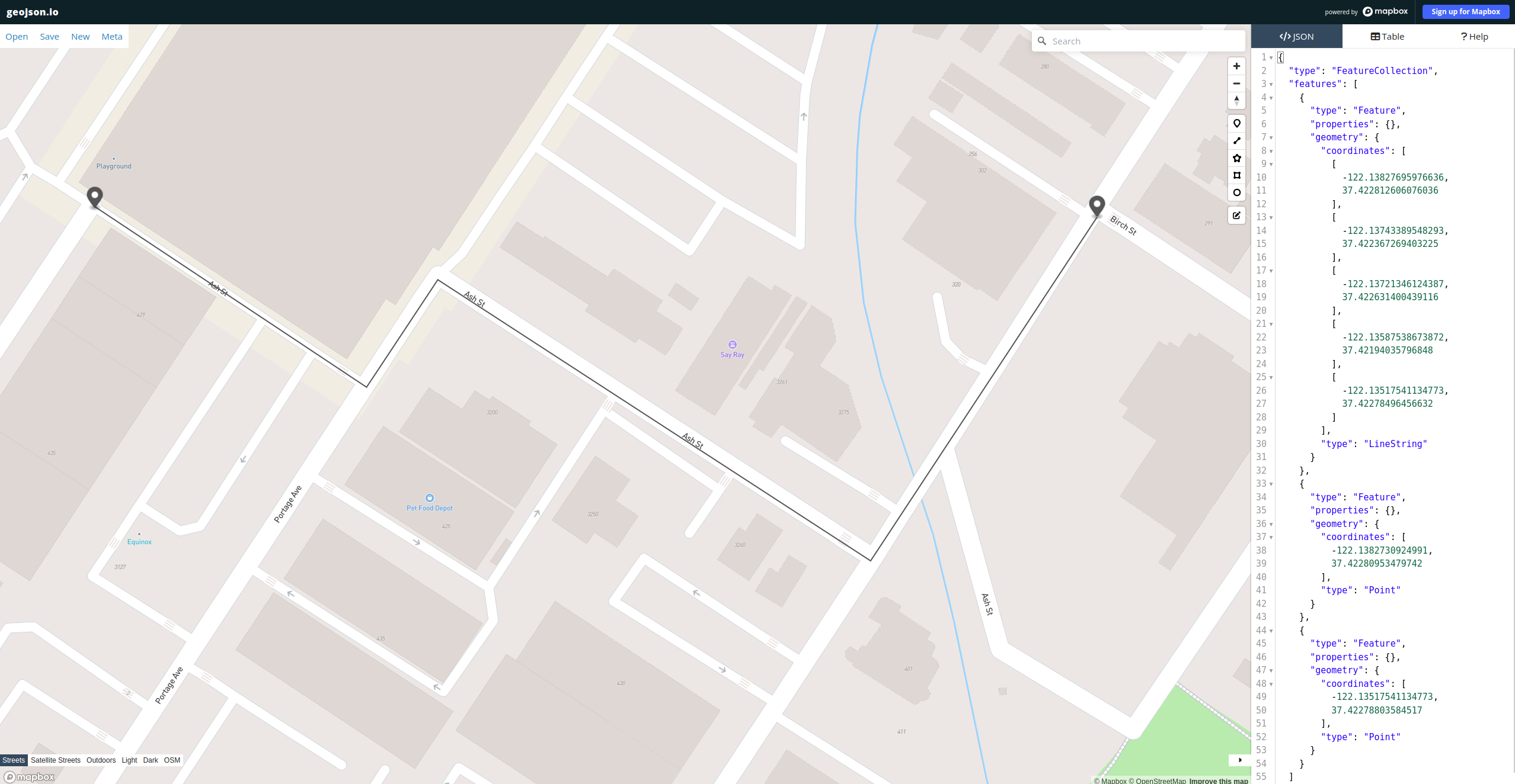
A dynamic routing engine that allows for parsing/processing data from OpenStreetMap files, and determines the optimal path/distance between any two road-based points. Output is generated in the form of a .geojson file which can be visually displayed via any geojson tool(ie. https://geojson.io/). The code is currently functional, but further optimizations and features are in development.
Click the GitHub logo below to view GitHub repo (includes code and documentation).